
Table of Contents
The AGV navigation system is the core technology enabling the autonomous movement of AGVs, directly impacting their operational efficiency, precision, and adaptability.
Definition of AGV Navigation Systems
The AGV navigation system is the core technological system that enables Automated Guided Vehicles to move autonomously. Its primary function is to help the AGV determine its position, plan travel paths, and accurately track those paths to complete tasks such as material handling. The AGV navigation system mainly consists of a positioning module, a path planning module, and a path tracking module. Through the coordinated cooperation of these modules, the AGV navigation system allows the vehicle to efficiently and accurately complete material transportation tasks without human intervention. It is widely used in fields such as manufacturing, warehousing, logistics, and ports.
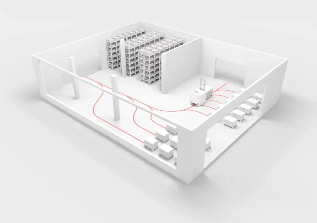
Key Technologies of AGV Navigation Systems
| Positioning: Positioning involves determining the mobile robot’s position and heading relative to a global coordinate system within its operating environment. It is the most fundamental part of AGV navigation. Currently, AGV positioning methods are divided into relative positioning and absolute positioning. Relative positioning can provide continuous position and attitude information, but suffers from cumulative errors. Absolute positioning can provide accurate position information, but struggles to provide continuous attitude information. Relative and absolute positioning methods are highly complementary, so a combined positioning approach integrating both is often used.
| Environment Perception and Modeling: To achieve autonomous AGV navigation, various sensors are needed to identify diverse environmental information, such as road boundaries, terrain features, obstacles, and guides. Through environment perception, the AGV determines accessible and inaccessible areas in its direction of travel, establishes its relative position within the environment, and predicts the movement of dynamic obstacles. This provides the basis for local path planning.
| Path Planning: Path planning is a crucial part of navigation. Based on the level of environmental information the AGV possesses, it can be divided into two types: global path planning, based on known environmental information, and local path planning, based on sensor information. In the latter case, the environment is unknown or partially unknown, meaning information such as the size, shape, and position of obstacles must be acquired through sensors.
AGV Navigation Types
AGV navigation is one of the core parts of an AGV robot, allowing it to know its location and guiding its direction and path. There are many common AGV navigation methods, most of which are already mature and widely applied.
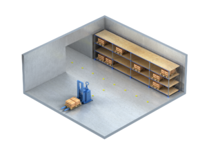
The principle is quite similar to electromagnetic guidance. Magnetic tape is laid along the AGV’s travel path, and onboard electromagnetic sensors identify the magnetic field signals for guidance. The main advantages of magnetic tape guidance are mature and reliable technology, low cost, relatively easy tape laying, easier path extension and modification compared to electromagnetic guidance, clear travel routes, and immunity to acoustic and optical interference.

Disadvantages are that the path is exposed, making it susceptible to mechanical damage and contamination, requiring regular maintenance; it is also susceptible to interference from ferromagnetic materials; and once the AGV starts a task, it can only follow the fixed tape and cannot alter the task. This AGV navigation is suitable for situations involving floor-embedded, light-load towing.
This AGV navigation method can be used in non-ferrous metal floors, non-demagnetizing indoor environments, enabling stable and long-term operation. Traditional navigation methods, represented by electromagnetic and magnetic tape navigation, because the guide wires are pre-buried along the entire path, have advantages such as simple map establishment, easy creation of a navigation coordinate system, and positioning by detecting the deviation between the vehicle and the pre-buried guide wire using corresponding sensors. However, they suffer from poor positioning accuracy and the inability to change the route once the wires are buried.
Magnetic spot navigation requires laying a large number of magnetic spots. Its advantages are low cost, mature technology, good concealment, better aesthetics compared to magnetic tape navigation, strong anti-interference capability, wear resistance, and acid/alkali resistance. Disadvantages are that the AGV path is easily affected by ferromagnetic materials, changing the path involves significant construction work, and the installation of magnetic spots can have a certain impact on the ground. Magnetic spot guidance is often used in port AGVs. It generally appears as an auxiliary navigation method to improve AGV positioning accuracy.
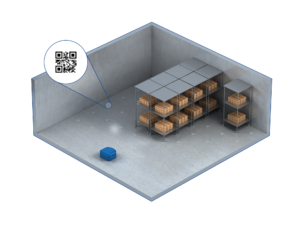
The landmarks for QR code navigation coordinates are QR codes on the ground. QR code guidance is quite similar to magnetic spot guidance, differing only in the type of landmark used. QR code navigation involves the AGV using a camera to scan QR codes on the ground and parsing the code information to obtain its current position. QR code navigation is often combined with inertial navigation to achieve precise positioning.
The chessboard-like working mode of Amazon’s KIVA QR code navigation robots is impressive, leading other e-commerce companies and smart warehouses to adopt QR code navigation robots. The unit cost of QR code-guided mobile robots is low, but a large number of QR codes need to be laid at the project site, and the codes are prone to wear, resulting in high maintenance costs.
This AGV navigation method involves setting up optical landmarks (adhesive colored tape or painted lines) along the AGV’s travel path. An onboard optical sensor captures image signals for recognition and guidance. Optical guidance is quite similar to magnetic tape guidance. Its main advantages are a relatively easy path laying, easier path extension and modification compared to magnetic tape guidance, and low cost.
Disadvantages are that the colored tape is easily contaminated or damaged, has high requirements for the usage environment, the reliability of guidance depends on ground conditions, and the stopping positioning accuracy is relatively low. This AGV navigation is suitable for situations with clean working environments, good ground flatness, and where AGV positioning accuracy requirements are not high.
Electromagnetic navigation is a traditional guidance method. It involves burying metal wires along the AGV’s travel path and applying a low-frequency, low-voltage current to these wires to generate a magnetic field. The AGV uses onboard electromagnetic sensors to identify and track the strength of this guidance magnetic field for navigation. Pre-buried RFID cards are read to complete designated tasks.
The main advantages of electromagnetic guidance are that the metal wires are buried underground, offering strong concealment and resistance to damage; the guidance principle is simple and reliable; it is immune to acoustic and optical interference; and manufacturing costs are low. Disadvantages include the troublesome process of laying the wires, difficulty in changing or extending paths, and susceptibility to interference from ferromagnetic materials like metal.
Laser navigation generally refers to navigation based on reflector positioning. The specific principle involves installing precisely positioned reflectors around the AGV’s travel path and mounting a laser scanner on the AGV body. As the AGV moves, the laser scanner emits laser beams. The beams are reflected directly back by the sets of reflectors placed along the path, triggering the controller to record the angle of the rotating laser head when it encounters a reflector. The controller matches these angle values with the actual positions of the reflector set to calculate the AGV’s absolute coordinates. Based on this principle, very precise laser guidance can be achieved.
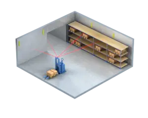
Laser navigation allows AGVs to plan paths flexibly, with accurate positioning, variable travel paths, convenient installation, and adaptability to various practical environments. Because the reflectors are positioned physically high, they are less prone to damage. During normal operation, the reflectors must not be obscured, as this would affect positioning.
Due to its relatively high cost, laser navigation currently does not hold a very high share in the AGV market. However, due to its advantages, it is expected to gradually replace some traditional navigation and guidance methods.
Natural navigation, also known as contour navigation or SLAM laser navigation, is a type of laser navigation. It also uses laser sensors to perceive its surroundings. The difference is that the landmarks for traditional laser navigation (with reflectors) are reflectors or reflective columns, whereas natural navigation can use features like walls in the working environment as landmarks, eliminating the need for reflectors. Compared to traditional laser navigation, natural navigation has lower installation costs and shorter project cycles. Its disadvantage is a greater reliance on environmental contours; accuracy may decrease if there are significant changes in the contour information along the travel path.
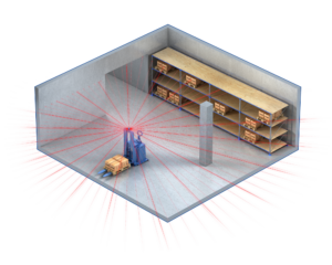
Vision navigation involves installing vision sensors on the AGV to capture image information of the surrounding area for navigation. Hardware requirements include downward-facing cameras, auxiliary lights, and light shields to support this method.
During movement, the AGV’s vision navigation system uses one or more cameras to capture images of the surrounding environment. After capturing ground textures, it automatically builds a map. It then compares this with texture images in its pre-built map, using phase correlation methods to calculate the displacement and rotation between the two images. Through integral estimation, it determines the AGV’s current position, thereby achieving positioning and navigation.
Vision navigation has strong environmental adaptability, but the computational load increases exponentially with the number of cameras and resolution, demanding high processor performance and cooling capabilities. It has certain requirements for ambient light and has relatively lower reliability.
Currently, vision navigation AGVs have limited market application. The advantages of visual texture navigation are low hardware cost and accurate positioning. Disadvantages are the need for textured floors and longer map-building time compared to laser navigation for large operating areas.
This method uses internal sensors for positioning, mainly optical encoders, gyroscopes, or both. Optical encoders on the AGV’s wheels provide pulse signals during movement for rough dead reckoning positioning. Gyroscopes capture the AGV’s triaxial angular velocity and acceleration, and position information is obtained through integral operations. The two dead reckoning methods can be fused. Inertial navigation offers low cost, high short-term positioning accuracy, good concealment, and strong anti-interference capability. However, errors accumulate over time, potentially leading to position loss. Therefore, inertial navigation is generally used as an auxiliary positioning method for other navigation methods.
It requires a long initial calibration time before use, and due to manufacturing technology limitations, high-precision gyroscopes are expensive and structurally complex, making large-scale popularization difficult.
This technology determines distance by simultaneously measuring the signal strength of wireless signals transmitted by multiple wireless APs to achieve positioning. Implementing indoor wireless AP positioning requires pre-installing numerous dedicated positioning APs in the environment and conducting extensive testing. Because each wireless AP requires cabling and debugging, and wireless AP signals are highly susceptible to interference from other devices in the environment, this method involves a large workload, high cost, and offers poor reliability and positioning accuracy in practical applications.
LBS base station positioning uses operator networks to obtain the location information of user mobile terminals. It leverages existing operator networks for positioning, requiring no additional infrastructure, making it convenient and fast. However, positioning accuracy depends on the quality of the operator’s network, and network signals are susceptible to interference from other devices. Due to the generally low density of operator base stations, this method suffers from poor positioning accuracy and reliability.
Methods using the geomagnetic field for indoor mapping are still in the theoretical research stage. Technical implementation is complex, and they are easily disturbed by equipment magnetic fields and geological activities.
This involves equipping the AGV with a GPS sensor to obtain position and heading information for navigation. GPS navigation has relatively low accuracy, with position errors around 10 meters, but offers fast real-time positioning, wide coverage, and simple operation. Disadvantages include susceptibility to weather, electromagnetic interference, and the need for operation in open areas with few obstacles. GPS navigation is mainly used for positioning in cars, ships, mobile phones, etc., and is rarely used for indoor AGV positioning, where high accuracy is required.
Combined navigation refers to methods that integrate two or more navigation techniques appropriately, leveraging their complementary characteristics to enhance the system’s overall navigation accuracy, real-time performance, and adaptability, enabling the AGV to operate effectively in various scenarios.
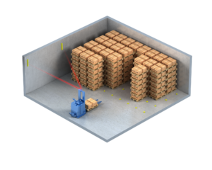
For example, combining QR code navigation with inertial navigation uses the high short-distance accuracy of inertial navigation to cover the navigation blind spots between two QR codes. Combining laser navigation with magnetic spot navigation uses magnetic spots at stations requiring high positioning accuracy to increase AGV positioning stability.
By combining navigation methods based on the application scenario to improve AGV performance, the strengths of each method can be utilized, overcoming the weaknesses of a single method. Therefore, combined navigation methods can sometimes achieve superior results, such as vision/inertial combined AGV navigation methods. The advantages of combined navigation include adaptability to various usage scenarios, relative flexibility, and easier path modification. Consequently, its application across various industries is expected to become increasingly widespread.
Currently, mature combined navigation technologies include: AGV combined navigation systems based on magnetic spot technology and inertial navigation; combined AGV navigation methods using laser and infrared navigation; methods combining laser radar and QR code landmarks; AGV guidance systems based on GPS/DR information fusion; dual-camera scanning methods based on QR code navigation combined with inertial navigation; combined navigation methods using vision and inertial navigation systems; AGV combined navigation methods using inertial and vision systems; precise positioning methods combining multi-view vision and laser navigation; navigation methods combining inertial navigation systems with buried RFID tags; methods combining inertial navigation systems with Ultra-Wideband (UWB) and landmarks, and so on.
AGV Navigation Comparison
|
Navigation Method |
Advantages | Disadvantages |
| Magnetic Tape Navigation | – Low cost, suitable for large-scale applications | – Complex path modification, magnetic tape prone to breakage, requires regular maintenance |
| – High positioning accuracy | ||
| QR Code Navigation | – Accurate positioning, suitable for small flexible environments | – Path needs regular updates, requires re-laying when damaged |
| – Convenient management and control, immune to acoustic and optical interference | ||
| Laser Navigation | – High positioning accuracy, suitable for complex environments | – Relatively high cost, high environmental requirements, complex technology |
| – Capable of dynamic path planning | ||
| Inertial Navigation | – Low cost, high accuracy for short durations | – Accuracy decreases over time, affected by cumulative errors |
| – Simple maintenance | ||
| SLAM Vision Navigation | – Can build maps in real-time in unknown environments, with high flexibility | – Computationally complex, high demands on software and hardware
|
| – Does not rely on fixed navigation markers |
How To Choose The Right AGV Navigation System
There is no single “best” AGV navigation method; different applications require different AGV navigation systems. When selecting an appropriate AGV navigation system, multiple factors need comprehensive consideration.
| Application Scenarios: If the AGVS is deployed in a fixed-path scenario, such as a standardized warehouse or other fixed production line, magnetic guidance navigation (magnetic tape or spots) can be chosen. These methods offer high positioning accuracy (±5mm) and strong stability.
If the AGVS is deployed in a dynamic environment scenario, such as an e-commerce warehouse or flexible production line, SLAM navigation (laser or vision) is recommended. These systems enable real-time mapping and obstacle avoidance, adapting well to environmental changes, although procurement costs are relatively high.
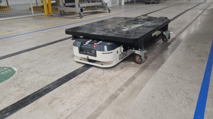
If the AGVS is deployed in a human-robot collaboration scenario, the AGV navigation system needs to have real-time obstacle avoidance functions, such as SLAM navigation or laser navigation, to ensure safety.
| Positioning Accuracy Requirements: For high-precision applications like semiconductor manufacturing or precision assembly, magnetic guidance navigation or laser navigation can be prioritized, with accuracy reaching ±5mm to ±10mm.
For medium-precision scenarios like general warehousing or logistics sorting, SLAM navigation or QR code navigation can meet requirements, with accuracy around ±10mm to ±20mm.
| Environmental Adaptability: For AGVs used in harsh environments like low temperatures or high humidity, magnetic guidance navigation or laser navigation is more stable. Additionally, sensors require effective protection, with protection levels needing to reach IP67 or higher.
For AGV navigation systems used in environments with significant light variation, vision navigation should be avoided due to lighting issues. Laser navigation or SLAM navigation can be chosen instead.
| Cost and Return on Investment: Enterprises must first consider the initial investment for different AGV navigation systems. Magnetic guidance navigation has the lowest cost, while SLAM navigation has the highest. Selection should be based on the company’s budget. Generally, small and medium-sized enterprises can prioritize magnetic or laser navigation.
Enterprises should also consider the long-term operational costs. Magnetic guidance navigation has low maintenance costs, while SLAM navigation requires periodic algorithm upgrades and maintenance. A comprehensive evaluation of the payback period and long-term benefits is necessary.
| Scalability and Flexibility: Enterprises need to plan for their production lines. If the AGVS path needs frequent adjustment or the number of AGVs is expected to increase in the future, SLAM navigation or hybrid navigation (e.g., laser + UWB) is more suitable, supporting dynamic path planning and multi-vehicle coordination.
If the production line and AGVS paths are relatively fixed with low expansion needs, magnetic guidance navigation or QR code navigation can meet the requirements.
| Supplier Support and Service: Enterprises should choose suppliers with good reputations, extensive industry experience, and comprehensive after-sales service to ensure the stable operation of the navigation system.
Enterprises also need to inquire whether the supplier has plans for algorithm upgrades for the AGV navigation system. This can extend the service life of the AGVs and reduce the company’s overall costs.
AGV Navigation Software
| SLAM Algorithm Software: Such as Cartographer, Gmapping, etc., which use LiDAR or vision sensors to build environmental maps in real-time and localize the AGV, enabling autonomous navigation.
| Path Planning Algorithm Software: Software implementing algorithms like A*, Dijkstra, RRT, etc., used to calculate optimal or suboptimal paths for the AGV from its start point to the target point.
| Map Building and Management Software
| Siemens SIMOVE ANS+: Supports laser SLAM mapping, can generate environmental maps in real-time, and provides map editing, expansion, and management functions.
| Task Scheduling and Management System Software
| ProfControl V8: An automation control system for smart factories and intelligent logistics, supporting multi-AGV scheduling, task allocation, and path optimization. It can integrate functions such as WMS and WCS.
| Visual Perception and Recognition Software
| OpenCV: An open-source computer vision library used for image processing, object detection, and recognition, assisting AGVs in environmental perception and obstacle detection.
| Simulation and Testing Software
| V-REP (now named CoppeliaSim): A robot simulation software that can simulate AGV movement and navigation in a virtual environment, validating algorithms and system designs.
| Communication and Integration Software
| ROS (Robot Operating System): A robotics operating system providing communication middleware and tools, supporting communication and data exchange between AGVs and external devices such as PLCs and sensors.
| Siemens SIMOVE ANS+: Supports standard communication protocols such as VDA5050, enabling seamless integration with host systems (e.g., MES, ERP) for data sharing and collaborative work.
AGV Navigation Algorithms
| Algorithms Used in AGV Path Planning
| Dijkstra’s Algorithm: Used to solve the single-source shortest path problem in weighted graphs. Based on a greedy strategy, it selects the node with the current shortest distance as the next processing object. Suitable for global path planning in static environments, but has high time complexity.
| A Algorithm:* An optimization of Dijkstra’s algorithm. It introduces a heuristic function to estimate the distance from the current node to the target, enabling faster identification of the optimal path. Suitable for path planning in complex environments, but sensitive to the choice of heuristic function.
| D Algorithm:* An incremental path planning algorithm based on A*. It can dynamically update paths to adapt to environmental changes. Suitable for path planning in dynamic environments, but path smoothness may be poor.
| Rapidly-exploring Random Tree (RRT) Algorithm: Achieves path planning by randomly sampling points in the environment and building a tree structure towards the target point. Suitable for high-dimensional spaces and dynamic environments, but paths may be random.
| Probabilistic Roadmap (PRM) Algorithm: Builds a probabilistic roadmap by sampling random points in the environment and then searches for connections between sampled points to form a route. Suitable for complex dynamic environments, but computationally intensive.
| Algorithms Used in AGV Obstacle Avoidance
| Artificial Potential Field Method: Treats obstacles and the target point as sources of repulsive and attractive forces, respectively. The AGV moves under the influence of the combined potential field, achieving obstacle avoidance and path planning. However, it is prone to local optima and path oscillation issues.
| Dynamic Window Approach (DWA): Predicts the possible reachable area in the next moment based on the AGV’s current position, velocity, and sensor data, selecting the optimal control command. It has strong real-time performance but relies heavily on environmental parameters.
| Vector Field Histogram (VFH) Method: Establishes a grid around the sensor, forms a polar histogram based on obstacle distribution, and selects the path with the lowest cost. It has a fast computation speed but limited processing speed and accuracy.
| Bug Algorithm: Based on boundary-following control, it navigates by moving towards the target and moving around the edges of obstacles encountered. Simple in structure, but relies heavily on sensor data and cannot handle dynamic obstacles.
Recommended Reading from AI Robots Eidos
Obstacle avoidance technology is a key technology for achieving intelligent and efficient operation of AGVs, directly impacting their effectiveness and safety in applications within fields such as logistics and manufacturing. As technology continues to advance, obstacle avoidance technology will become more precise and intelligent, further driving the widespread application of AGVs in complex environments.
If you are interested in obstacle avoidance technology, please read this in-depth article on obstacle avoidance.
| Algorithms Used in AGV Positioning and Mapping
| SLAM Algorithm (Simultaneous Localization and Mapping): Builds a map of the environment in real-time using sensor data while simultaneously determining the AGV’s position within that map. Common types include laser SLAM and visual SLAM. Suitable for navigation in unknown environments.
| Kalman Filter Algorithm: Used for fusing sensor data to estimate the AGV’s state (e.g., position, velocity), improving positioning accuracy. Often combined with other algorithms.
| Particle Filter Algorithm: Represents the AGV’s state distribution using a set of random particles and updates particle weights based on sensor observations. Suitable for positioning problems with non-linear, non-Gaussian distributions.
Development Directions of AGV Navigation Systems
| Distributed Algorithm Optimization: Based on algorithms like reinforcement learning and distributed artificial intelligence, AGVs will possess autonomous negotiation and collaborative planning capabilities. For example, through distributed reinforcement learning, AGVs can dynamically adjust their paths and speeds based on the status of surrounding robots and task priorities, avoiding collisions and optimizing overall operational efficiency.
| Transformer-Based End-to-End Navigation: This is one of the important development directions for AGV navigation systems. Traditional navigation systems require separate design of perception, planning, and control modules. In contrast, Transformer-based end-to-end navigation integrates the entire process into a single neural network model, mapping directly from sensor input to control commands. This end-to-end learning approach reduces error propagation between modules, improves the system’s overall performance and adaptability, and enables quicker strategy adjustments, especially in dynamic environments.
| Multi-Sensor Fusion Algorithms: Combining data from various sensors, such as LiDAR, vision sensors, Inertial Measurement Units (IMUs), and wheel odometry through data fusion techniques, synthesizes the strengths of each sensor. This improves positioning accuracy and environmental perception capabilities, thereby compensating for the limitations of single sensors (e.g., LiDAR’s shortcomings in dynamic environments, vision sensors’ stability issues under varying lighting conditions) and enhancing the robustness and adaptability of the navigation system.
Insight from AI Robots Eidos about AGV Navigation Systems
The current AGV navigation, whether through laser SLAM or visual navigation, mainly focuses on geometric understanding (mapping, walls, obstacles, and paths). In the future, however, it will shift towards semantic navigation, where AGVs will move beyond identifying “where” to understanding “what.” By integrating large language models and advanced computer vision, AGVs will be able to understand their environment contextually. For instance, an AGV will not only detect obstacles but also recognize “a fallen cardboard box,” “a pallet waiting to be picked,” or “a moving employee.” This semantic layer will allow AGVs to make smarter decisions, such as predicting human movement or prioritizing certain paths based on real-time activities (rather than just pre-set static paths).
Future AGV navigation will go beyond individual vehicle path planning and shift towards collective intelligence navigation. AGVs will form a dynamic, self-organizing network, not merely avoiding collisions, but actively negotiating right of way. They will dynamically establish temporary queues to navigate through bottleneck areas and leave “virtual pheromone trails” based on experience, guiding subsequent vehicles to select more efficient paths. This collective behavior will endow the entire logistics system with a high degree of adaptability, robustness, and scalability that far exceeds the capabilities of current centralized scheduling.
Image Credits: Solving & Materialfluss & Rmgroupuk
Other Articles on The Topic of AGVs
Level A (Foundational )