
Table of Contents
Lidar SLAM vs visual SLAM is the topic of this article. AI Robot Eidos addresses this topic not to argue which navigation method is better, but to explain the differences between the two from various perspectives, helping users make better choices in practical applications. The article also notes that multi-sensor fusion is the future direction of development.
What Is Visual SLAM (vSLAM)?
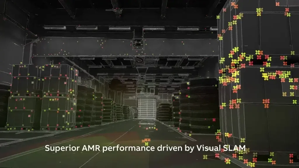
Visual SLAM (Visual Simultaneous Localization and Mapping) is a technique based on vision sensors. The device analyzes image information captured by a camera or video camera, extracts feature points, performs matching and tracking, and thereby acquires visual features of the environment for localization and mapping. Taking a building as an example, a visual SLAM algorithm identifies feature points such as wall corners and window edges from the building’s image information. By tracking the positional changes of these feature points across different images, it calculates the device’s motion trajectory and the structural information of the building. Combined with data from LiDAR and IMU, it ultimately constructs a high-precision 3-Dimensional map.
What Is Lidar SLAM?
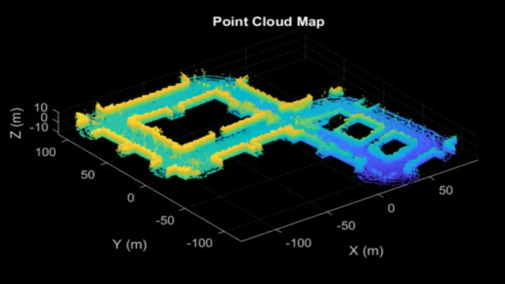
Lidar SLAM (Light Detection and Ranging Simultaneous Localization and Mapping) is a technology that enables an autonomous system to build a map of an unknown environment while simultaneously determining its own position within that map in real time. The technology relies on a LiDAR sensor that emits laser beams and measures the time of reflected light to obtain distance information about the surrounding environment, generating point cloud data. These point cloud data are like countless tiny coordinate points that accurately describe the positions and contours of surrounding objects, providing rich geometric information for map construction and using that information to estimate the robot’s position and orientation within the map.
Recommended In-depth Reading from AI Robots Eidos
A comprehensive understanding of LiDAR SLAM and visual SLAM helps clarify the technical principle differences between the two, analyze their performance characteristics, and understand their respective application scenarios. Additionally, it aids in better designing fusion algorithms, leveraging each one’s strengths, and enhancing system accuracy.
If readers wish to gain an in-depth understanding of LiDAR SLAM and Visual SLAM technologies, they should refer to relevant articles on LiDAR SLAM and Visual SLAM. This allows for a better understanding of Lidar SLAM vs. Visual SLAM.
Lidar SLAM vs Visual SLAM (vSLAM): Principles
Lidar SLAM: Lidar SLAM directly measures the distance and angle between the sensor and surrounding objects by emitting laser beams and receiving reflected signals, generating high-precision point cloud data that reflects the geometric structure of the environment. It typically employs point cloud registration algorithms (such as ICP, NDT) to calculate the relative pose transformation between consecutive point cloud frames, determining the sensor’s position and orientation in space through iterative optimization. From these principles, it is clear that the advantage of lidar SLAM is its high accuracy, providing precise maps and localization information. It performs excellently in indoor environments and enclosed spaces, and is very effective for obstacle avoidance and mapping tasks.
Visual SLAM: Visual SLAM uses cameras to capture images of the environment, sensing the environment through feature points, textures, colors, and other information in the images, relying on optical imaging principles to acquire visual information of the scene. Based on feature point matching (such as ORB, SIFT) or direct methods (such as photometric consistency assumption), it estimates the device’s motion trajectory and pose by calculating the correspondences between feature points or changes in pixel intensity. Compared to lidar SLAM, visual SLAM performs relatively better in outdoor environments because laser light can be disturbed by weather, lighting, and occlusion outdoors.
Lidar SLAM vs Visual SLAM (vSLAM): Localization And Mapping Accuracy
In static and simple environments, lidar SLAM generally outperforms visual SLAM in localization; however, in large-scale and dynamic environments, visual SLAM shows better results due to its ability to extract texture information.
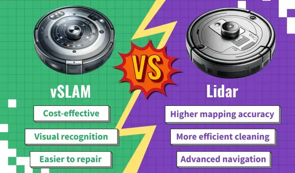
In terms of mapping, LiDAR SLAM is characterized by higher accuracy in single points and individual measurements. Lidar SLAM can typically achieve centimeter-level or even millimeter-level localization accuracy, resulting in highly accurate maps. However, the amount of map information is smaller than that obtained through visual SLAM. Visual SLAM, especially methods that estimate distance via triangulation, generally has lower accuracy for single points and single measurements than lidar. The localization accuracy of visual SLAM is typically at the centimeter-to-decimeter level, influenced by factors such as image quality and feature richness. It can be repeatedly improved through loop closure and simultaneously provides richer map information.
Lidar SLAM vs Visual SLAM (vSLAM): Cost
LiDAR sensors come in many grades, and their costs are generally higher than those of vision sensors. The most expensive, such as Velodyne’s long-range outdoor multi‑line LiDAR, can cost over a hundred thousand dollars, while high‑end mid‑to‑long‑range planar LiDAR for outdoor use, such as those from SICK and Hokuyo, cost around ten thousand dollars. Even low‑to‑mid‑range short‑range planar LiDAR, which is widely used indoors, is priced comparably to high‑end industrial‑grade cameras and image sensors. In the future, the cost of LiDAR may decrease with mass production, but whether it can drop to the level of cameras of the same class remains questionable.
Lidar SLAM vs Visual SLAM (vSLAM): Stability
Most common LiDAR sensors today are rotating scanning types. The internal mechanical structure that remains in rotation over long periods can introduce instability into the system, which is particularly noticeable under bumps and vibrations. Cameras, on the other hand, do not contain moving mechanical parts, have lower space requirements, and can be installed in a wider range of scenarios. However, the gradual maturity of solid-state LiDAR may help LiDAR SLAM overcome this disadvantage.
Lidar SLAM vs Visual SLAM (vSLAM): Applications
Lidar SLAM is broadly divided into indoor and outdoor applications depending on the grade of LiDAR used, while visual SLAM has rich application scenarios both indoors and outdoors. The main issue with visual SLAM is lighting variation. For example, when localizing and mapping outdoors at noon, its stability is inferior to that of high‑end outdoor multi‑line LiDAR. In recent years, lighting model correction and highly robust feature points based on deep learning have been widely applied in visual SLAM research, showing good results. As these technologies advance, visual SLAM will become more stable in environments with lighting changes.
Lidar SLAM is not good at localization in dynamic environments, for instance, when many people occlude its measurements, nor does it perform well in geometrically similar environments, such as a long, straight corridor with walls on both sides. Due to its poor relocalization ability, lidar SLAM struggles to resume operation after tracking loss. In contrast, visual SLAM performs poorly in texture‑less environments (e.g., a clean white wall) and under extremely low lighting.
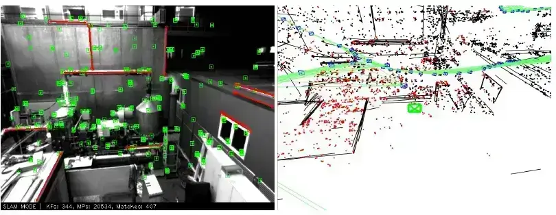
Visual SLAM is suitable for construction and engineering fields. Using visual SLAM technology to perform 3-Dimensional scanning and modeling of engineering structures such as buildings, bridges, and tunnels allows rapid acquisition of structural geometric information for design, construction monitoring, and maintenance planning, providing data support for project management.
Lidar SLAM is suitable for precise navigation, 3-dimensional reconstruction, robot path planning, and other scenarios, especially in fields requiring high‑precision spatial information (e.g., industrial robots).
Lidar SLAM vs Visual SLAM: Examples
Lidar SLAM for Earthwork Measurement
Lidar SLAM uses automatically generated stereo point clouds to precisely measure the structure of piled materials from all orientations. The point cloud data is then processed for subsequent earthwork volume calculations. This operational method not only saves time and enhances efficiency but also significantly reduces costs. More importantly, the accuracy of volume calculations is greatly ensured.
Visual SLAM for Bridge Inspection
Drones equipped with Visual SLAM systems, high-resolution cameras, IMUs, and flashlights employ the ORB-SLAM3 algorithm. On a bridge in the small town of Nendelven in Switzerland, visual SLAM was successfully implemented to achieve stable positioning and 3D modeling in an environment with no GNSS signals and poor lighting. Furthermore, by integrating AI defect detection algorithms, issues such as cracks and exposed rebar can be identified, providing digital evidence for the safety assessment of the bridge.
Lidar SLAM vs visual SLAM: Fusion
Advantages of Fusion
As mentioned at the beginning of this article, Lidar SLAM vs Visual SLAM is intended to help readers better understand thatthe fusion of multiple navigation methods or the fusion of many sensors is the future direction. To give readers a more intuitive understanding, we illustrate this with an image, which shows an environmental perception system based on the fusion of LiDAR and multiple vision sensors, including a 2-Dimensional grid map, 3-Dimensional point cloud, etc. The performance improvement can be clearly seen.
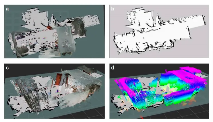
The future trend is to fuse more types of sensors, such as infrared cameras and IMUs, to obtain richer perceptual information, thereby improving localization accuracy and robustness under various extreme conditions.
Methods of Fusion
Visual SLAM excels at extracting rich details and texture information from camera images but its performance degrades in scenes lacking texture or under strong lighting. Lidar SLAM provides high‑precision distance measurement and stability under lighting changes or in texture‑less environments, although its acquisition frequency and field of view are limited. The fusion of the two can complement each other and be applied to a wider range of scenarios and tasks.
–Sensor‑level Fusion: Raw data are fused. First, time synchronization ensures that the data from different sensors corresponds to the same moment. Second, spatial alignment is performed. Because the LiDAR and camera are mounted at different positions, extrinsic calibration is needed to project their data into the same coordinate system. The fusion of sensor data produces an enhanced point cloud: by mapping the camera’s RGB data onto the LiDAR point cloud, a 3-Dimensional point cloud with color information is generated.
–Feature‑level Fusion: Visual features (e.g., corners, edges in images) and LiDAR features (e.g., planes, corners in point clouds) are extracted and then jointly optimized to achieve more accurate localization and mapping.
–Pose‑level Fusion: Visual SLAM computes the camera’s relative motion trajectory, providing visual odometry data; lidar SLAM computes the LiDAR’s pose changes, providing LiDAR odometry data. The poses are then fused and optimized using fusion algorithms.
–Backend optimization‑level Fusion: Graph optimization, loop closure detection, and other methods are used to optimize the estimated trajectory and map throughout the SLAM system.
Insight from AI Robots Eidos about Lidar SLAM vs Visual SLAM
Lidar SLAM vs Visual SLAM is not about “who replaces whom,” but rather about tight coupling and integration—solid-state LiDAR provides high-precision depth information, vision provides semantic textures, and IMU offers high-frequency motion priors. The three are optimized through tight coupling (such as factor-based graph optimization) to achieve a real-time, highly robust, and low-cost SLAM system.
Using deep learning for real-time instance segmentation of images allows for dynamic removal of features from moving objects; at the same time, the laser point cloud can distinguish dynamic from static points through semantic labeling. Ultimately, this constructs a static semantic map, significantly enhancing localization robustness in dynamic scenes.
By leveraging self-supervised learning, visual SLAM can autonomously learn light-invariant features and geometric priors in weakly textured scenes without labeled data. For instance, by using the real distances provided by LiDAR as supervisory signals, the visual network is trained to reliably extract features under strong light, shadows, and darkness. This cross-modal self-supervision will become a critical path for low-cost visual SLAM to overcome existing bottlenecks.
Image Credits: ABB & Web & Mathworks & Geosunlidar & Lidarusa & Medium & Gadgetreview